
Featured project · GLO Patent Mapping
PUBLIC DOMAIN TO PRIVATE HANDS
An interactive map of when the American public domain passed into private ownership. Every surviving General Land Office land patent is placed on the Public Land Survey grid and played back through time.
- Downloaded patent records state by state from BLM's GLO Records search, split into date ranges to get past its 100,000-record query limit.
- Parsed every legal description and placed each patent on its PLSS section, using BLM township polygons to correct grid drift. That cut North Dakota's median location error from 35 km to 8 km.
- Binned located patents by year and entry type, from homesteads to cash sales and railroad grants, for the time slider.
EXPERTISE
- Wildlife Connectivity
- Public Lands
- Policy and Economics in Geospatial Research
- Enterprise GIS
- Cartography
- Product Design and Deployment
- Data Administration
- Artificial Intelligence in Geospatial Technology
EXPLORATION, INNOVATION, COLLABORATION
Listen
Understand the decision, the audience, and the constraints before opening any software.
Build
Prototype analyses openly, document methods, iterate against feedback from partners on the ground.
Deliver
Hand off maps, data, and documentation built to outlast the project and support future work.
SELECTED PROJECTS
USFS Hazardous Fuel Treatments and 2026 Fires Investigation
Grassroots Wildland Firefighters
Dolores Conservation Recreation Area Development
Colorado Wildlands Project
Chaffee County Wildlife-Vehicle Collision Mitigation and Connectivity Planning
Eco-Resolutions for Chaffee County, CO
Roan Plateau Oil and Gas Leasing and Economic Value Analysis
Wilderness Workshop
ArcGIS Online Administration and Data Management
Wilderness Workshop
Hunter-Fryingpan Wilderness Field Maps Cartography
USFS, White River National Forest
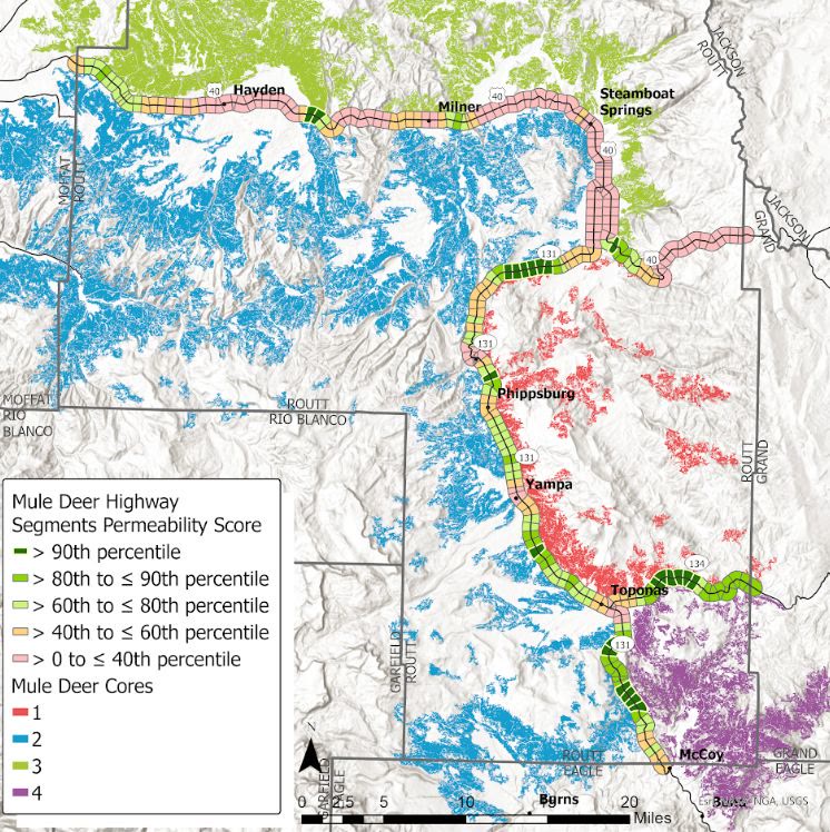
Prioritizing Wildlife-Transportation Mitigation in Routt County
Eco-Resolutions for TNC Colorado
GLO Records Data Mining and Time Series
Research
Explore the map →BLM Oil and Gas Leases Through Time
Research at The Wilderness Society
CLIENTS
- Rocky Mountain Wild
- Wilderness Workshop
- Audubon Vermont
- National Audubon Society
- Western Conservation Foundation
- US Forest Service
- The Nature Conservancy
- Eco-Resolutions
- BBA Water Consultants
- Roaring Fork Safe Passages
- MRV Collective
- State Political Maps
- Western Watersheds Project
- Grassroots Wildland Firefighters
- Colorado Wildlands Project
LET'S TALK.
Redstone GIS Consulting, LLC · Carbondale, Colorado